This is an article on part of the Gekím timeline, centered around the nation of Gekím.
Overview[]
The Gekíun Empire, known in the native language as gEkím, was originally founded as several, separate colonies and refugee sites from multiple independent countries, near the Bab el Mandeb Strait. These towns soon coalesced into a new, autonomous kingdom gaining a significant political standing among its neighbors. However, despite the rise of a nationalist fervor, the capitals were sacked by the Sabeans and the Daamat with the majority of the Gekíun citizens fleeing into exile.
Establishment[]
Yamato[]

A map depicting the Japanese state of Yamato before and after acquiring its colony.
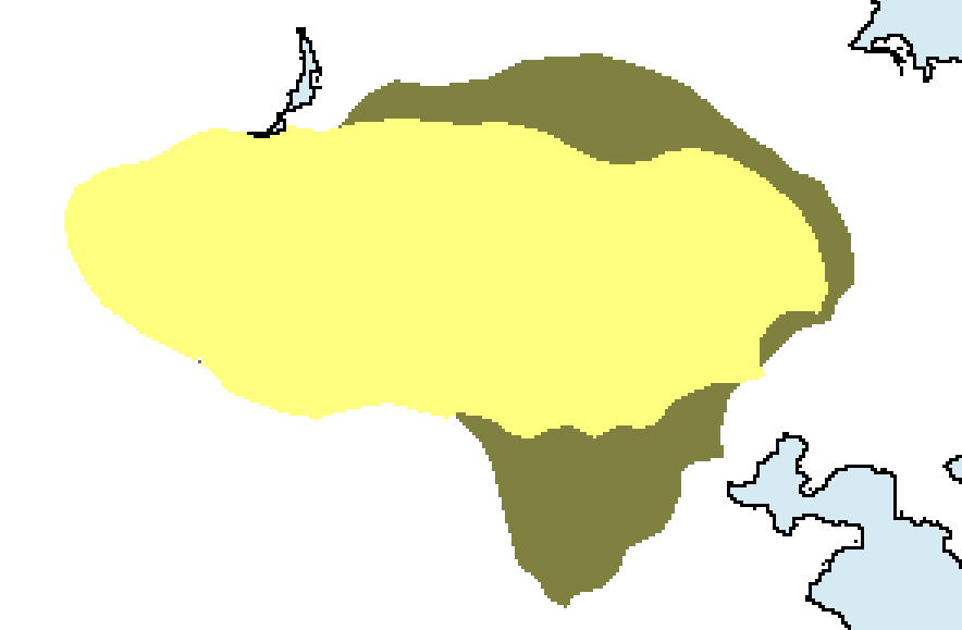
Around the year 587 BC, one of the Jin warlords of the Zhou Dynasty sent an emissary around the East China Sea, seeking to gain contacts with surrounding nations and perhaps even allies in the fight against the Chou leader, who had declared himself king. As one of the messenger fleets landed on the Eastern shore of Honshu and attempted to send their leader's regards, they were ambushed and killed. Their deaths were not the prize that the Japanese had been eyeing, though - the ships on the bay's shore were the true target, and since it was one of the best models available in the Orient, it allowed the people of Yamato to finally gain the upper hand against their rivals, and also take to the seas. As the island of Honshu grew more and more centralized, the accumulation of technology and political standing increased with it. With the creation of a new, partially-unified Japan, much of the archipelago's potential was unleashed, including the complete subjugation of the early states of Koguryo, Paekche, Kaya, and Silla as well as a significant amount of Manchuria.
As a result of the prosperity of the nation, along with the successful subjugation of the Korean peninsula, the Japanese decided to venture further outward. As international trade grew into the archipelago's economy, links to India, Taiwan, the Philippines and Sumatra were established in the 530's BC, continuing to enhance the nation's achievements. In the year 521 BC, a trading fleet was blown off course while en route to the newly discovered Saba, coming to land in the natural harbor that would eventually be known as dIjibutem (Djibouti), where the crews established a new settlement. This placement of this new Japanese colony was brilliant, as it provided a way to tax merchants traveling through the strait from the Red Sea to the Arabian. The wealth it produced was essentially transported back to Yamato, where it was used as backing for the defense of Manchuria from the Xiongnu. With help from the Zhou, the Japanese displaced the Xiongnu in 502 BC; these Mongols, later called Huns, fled across the Eurasian steppes to reek havoc upon other lands.

Two maps depicting the Zhou Dynasty and the Xiongnu before and after the three colonies were established
Magadha[]
A map depicting the Indian state of Magadha before and after acquiring its colony
In the year 515 BC, the great Buddha had recently reached nirvana, while Mahavira had started his claim to religious glory. As the majority of the people of the Ganges River Valley converted to the new faiths of Buddhism and Jainism, the previous religion - Brahmanism - lost many of its devoted followers. All throughout the kingdom of Magadha, from Baranasi to Kajangala, people were converting at a rapid pace, with those who refused feeling ever more secluded and at risk of religious persecution for maintaining their old religion. With the permission and backing of the new prince, the pilgrims entered the ships docked at Tamralipti and paid for their own removal. These ships were Japanese- the power of Yamato had become well known throughout the floodplains - and were headed to their rich colony of dIjibutem.
The passengers from these ships were settled in the spot where they would soon build the city of mAswem, a position similar to that of dIjibutem that allowed the management of shipping, but mostly provided a port for the Nubians to the south who had little access to the sea. Just like the Japanese, the wealth generated from the Indian colony provided the basis for the conquering of regional states, centering mostly upon the north and capturing Taxila 472 BC and Ujjain three years later. As Magadha grew in power and prowess, so did their colony at mAswem, which had annexed the surrounding land up to the territory held by dIjibutem.
Persia[]

A map depicting the Persian Empire before and after acquiring its colony
In the 470's BC, the Persian emperor Xerxes I had accumalated more land than any other nation on Earth. Therefore, some of his worst disputes were at home- this was the time of the Jewish Queen Esther and the Prince Haman, and the king had just decreed the elimination of all the Jews in the Persian Empire roughly less than a year into the future. As people around the nation found out, many Jews tore their clothing and prayed for months on end, but some did not - particularly those living in the city of Babylon at the time of the proclamation. Instead, they thought of fleeing the country by sea to any place willing to accept them. However, well into the voyage a typhoon blew up, and wrecked them on an island in the Indian Ocean. It was not very much later before a merchant fleet discovered them there on Socotra, and the Indians easily agreed to bring them to the destinations for which they had already planned- mAswem and dIjibutem.
Prior to landing, the Indians had arrived at an incredible idea, and let the Persian Jews off at a bay to the south of dIjibutem. They began to call it bRibem (Berbera), and established themselves a presence in the seas' community. When Esther had finally gained the freedom for her people, she sent a messenger to seek out the colonists, and upon return to the mainland, they informed the King and Queen of their new possession and the prosperity coming from its control of trade from the southern coast of Africa. The Persian army was immediately built up to a standard noncompetitive with the other nations of the world due to the large sums of income arriving from the African port, and the success was unparalleled.
Independence[]

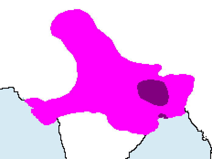
A map depicting the three colonies before and after acquiring their independence
| |||
| Capital | dIjibutem (Djibouti), mAswem (Massawa), & bRibem (Berbera) | ||
| Largest city | dIjibutem (Djibouti) | ||
| Other cities | zÁlem (Zeila) | ||
| Language official |
Proto-Gekíje | ||
| others | Elamite, Japanese, Sanskrit, Ethiopic | ||
| Emperor | See below | ||
| Population | Unknown | ||

This
section
on
independence
will
be
filled
in
soon.
please
be
patient:
There
is
more
to
come.
==First Exile==
| |||||
| Other cities | lUksem (Thebes), mIdenem (Medina), hOlem (Jerusalem) | ||||
| Language official |
Proto-Gekíje, Elamite | ||||
| others | Coptic Egyptian, Hebrew, Aramaic, Arabic | ||||
| Emperor | See below | ||||
| Population | Unknown | ||||


This
section
on
exile
will
be
filled
in
soon.
please
be
patient:
There
is
more
to
come.
==Rulers of gEkím==
- S Sórán Karádron
- Bórán Karádron
- Fobeák Karádron
- S Şurkáұin Karádron
- Ponák Karádron
- Dokuláun Karádrón
- Jódála Karádrón
- & S Dejódála Karádrón
- Hongaұin Korádron
- Ejiptídron Korádron
- _________ Korádron
- Judawídron Korádron
- Zíanzináun Korádron
- Durkádrondedron Másedonídron (Alexander the Great of Macedon)
- B Sórán Áskwácádron
- Deilumáun Áskwácádron
- Devenádron Áskwácádron
- B Şurkáұin Áskwácádron
- Injádrón Áskwácádrón