There are currently 21 overseas territories which are owned by the United Kingdom. There are three in Europe, one in the Middle East, one in the Pacific, four in the South Atlantic Ocean, one in the Indian Ocean, one in Africa, One in Asia and nine in North America and the Caribbean. The territories of Aden, Belize, Cyprus, Falkland Islands, Gibraltar, Grenada, Hong Kong, Malta, Montserrat, Saint Helena and Somaliland have their own Minister of States in the Foreign and Commonwealth Office of the British Government.
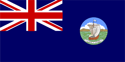
Aden[]
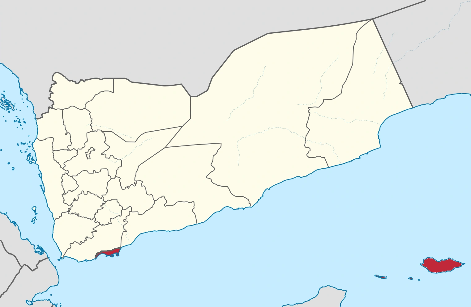
Aden is a British Overseas Territory in the Middle East. It has a BP oilfield, an airfield used by the RAF and commercial aircraft and a port which is the second busiest in the world just behind New York.

Flag of the British Overseas Territory of Aden
Location of the British Overseas Territory of Aden
Administration[]
The Aden Parliament is a devolved parliament which can decide on matters from parts of Economy to Social Security (Defence and a bit of Economy are reserved). There are four parties which are, Aden Conservatives, Aden Labour, Aden Liberal Democrats and Aden National Party. The Aden Conservatives are in power at the moment.
West Aden (formerly Little Aden)[]
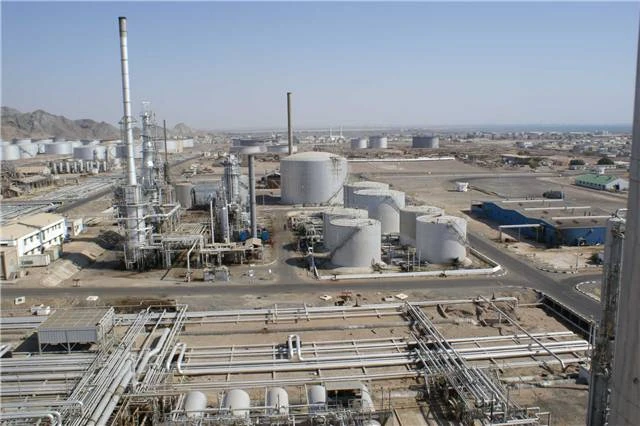
West Aden is still dominated by the oil refinery built for British Petroleum. West Aden is well known to seafarers for its tanker port with a very welcoming seaman's mission near to the BP Aden tugs' jetties, complete with swimming pool and air conditioned bar. The accommodation areas for the refinery personnel were known by the original Arabic names of Bureika and Ghadir.
The BP refinery in West Aden
Bureika was wooden housing bunkhouses built to accommodate the thousands of skilled men and labourers imported to build the refinery, It has since been converted to family housing, plus imported prefabricated houses "the Riley-Newsums" that are also to be found in parts of Australia (Woomera). Bureika also has a protected bathing area and Beach Club.
Ghadir housing was stone built, largely from the local granite quarry; much of this housing still stands today, now occupied by wealthier locals from Aden. West Aden also has a local township and numerous picturesque fishing villages, including the Lobster Pots of Ghadir. During the Aden Emergency, The British Army had extensive camps in Bureika and through Silent Valley in Falaise Camp, these successfully protected the refinery staff and facilities throughout the troubles, with only a very few exceptions. Schooling is provided for children from kindergarten age through to primary school, after that, children were bussed to The Isthmus School in Khormaksar, though this had to be stopped during the Aden Emergency.
Anguilla[]
Anguilla is a British overseas territory in the Caribbean. It is one of the most northerly of the Leeward Islands in the Lesser Antilles, lying east of Puerto Rico and the Virgin Islands and directly north of Saint Martin. The territory consists of the main island of Anguilla itself, approximately 16 miles (26 km) long by 3 miles (5 km) wide at its widest point, together with a number of much smaller islands and cays with no permanent population. The island's capital is The Valley. The total land area of the territory is 35 sq mi (90 sq km), with a population of approximately 13,500 (2006 estimate).


Flag of the British Overseas Territory of Anguilla
Administration[]
Anguilla is an internally self-governing overseas territory of the United Kingdom. Its politics take place in a framework of a parliamentary representative democratic dependency, whereby the Chief Minister is the head of government, and of a pluriform multi-party system.
The United Nations Committee on Decolonization includes Anguilla on the United Nations list of Non-Self-Governing Territories. The territory's constitution is Anguilla Constitutional Order 1 April 1982 (amended 1990). Executive power is exercised by the government. Legislative power is vested in both the government and the House of Assembly. The Judiciary is independent of the executive and the legislature. There are 3 parties which are Anguilla United Movement (governing), Anguilla United Front and Anguilla Progressive Party.
Belize[]
Belize is the name of a British Overseas Territory on the east coast of Central America, south of Mexico. At the moment, Guatemala claims the Overseas Territory as part of Guatemala. This has restricted several independence attempts in 1981 (Yes 35% No 65%), 1990 (Yes 43% No 57%), 2002 (Yes 40% No 60%) and 2010 (Yes 45% No 55%).


.svg)
Flag of the British Overseas Territory of Belize
Administration[]
Belize is an internally self-governing overseas territory of the United Kingdom. Its politics take place in a framework of a parliamentary representative democratic dependency, whereby the Prime Minister is the head of government, and of a pluriform multi-party system. There are two parties which are the center-left People's United Party and the center-right United Democratic Party.
Bermuda[]
Bermuda is a British Overseas Territory in the North Atlantic Ocean, located off the east coast of North America. Its nearest landmass is Cape Hatteras, United States, about 1030 km (640 mi) to the west-northwest. It is about 1239 km (770 mi) south of Cape Sable Island, Canada, and approximately 1000 km (620 mi) north of the Caribbean. Its capital city is Hamilton.


Flag of the British Overseas Territory of Bermuda
Administration[]
The current ruling party in Bermuda is the One Bermuda Alliance, commonly referred to as the OBA. They were voted into power in December 2012 after Bermuda was ruled by the Progressive Labour Party for 14 years, from 1998 to 2012.
Executive authority in Bermuda is vested in the monarch and is exercised on her behalf by the Governor. The governor is appointed by the Queen on the advice of the British Government. The current governor is George Fergusson; he was sworn in on 23 May 2012. There is also a Deputy Governor (currently David ArkleyJP). Defence and foreign affairs are carried out by the United Kingdom, which also retains responsibility to ensure good government.
British Antarctic Territory[]
The British Antarctic Territory (BAT) is a sector of Antarctica claimed by the United Kingdom as one of its 20 British Overseas Territories and is by far the largest. It comprises the region south of 60°S latitude and between longitudes 20°W and 80°W, forming a wedge shape that extends to the South Pole, overlapping the Antarctic claims of Argentina (Argentine Antarctica) and Chile (Chilean Antarctic Territory).

Flag of the British Overseas Territory of British Antarctic Territory
Administration[]
The British Antarctic Territory is administered by the Foreign and Commonwealth Office (FCO). A Commissioner is appointed and is always the Head of the FCO's Overseas Territories Department.
The Territory has a full suite of laws, and legal and postal administrations. Given the provisions of the Antarctic Treaty System, the Territory does not enforce its laws on foreign nations who maintain scientific bases within the Territory. It is self-financing, with income from the sale of postage stamps and income tax.
British Indian Ocean Territory[]
The British Indian Ocean Territory (BIOT) is an overseas territory of the United Kingdom situated in the Indian Ocean halfway between Tanzania and Indonesia. The territory comprises the seven atolls of the Chagos Archipelago with over 1000 individual islands – many tiny – amounting to a total land area of 60 sq km (23 sq mi).


Flag of the British Indian Ocean Territory
The largest and most southerly island is Diego Garcia, 44 sq km (17 sq mi), the site of a joint military facility of the United Kingdom and the United States. Following the eviction of the native population, the Chagossians, in the 1960s and 70s, the only inhabitants are US and British military personnel and associated contractors, who collectively number around 4000 (2004 figures). The islands are off-limits to casual tourists, the media, and their former inhabitants.
Administration[]
As a territory of the United Kingdom, the head of state is Queen Elizabeth II. There is no governor appointed to represent the Queen on the territory, as there are no longer any native inhabitants. The head of government is the commissioner, currently Dr. Peter Hayes (since October 2012, replacing Colin Roberts), and administrator John McManus (since April 2011, replacing Joanne Yeadon), all of whom reside in the United Kingdom. The commissioner's representative in the territory is the officer commanding the detachment of British forces.
The laws of the territory are based on the constitution, set out in the British Indian Ocean Territory (Constitution) Order 2004, which gives the Commissioner full powers to make laws for the territory. If the Commissioner has not made a law on a particular topic then, in most circumstances, the laws that apply in the BIOT are the same as those that apply in England under the terms of the Courts Ordinance 1983. As almost all residents of the BIOT are members of the United States military, however, in practice crimes are more commonly charged under United States military law.
Applicable treaties between the United Kingdom and the United States govern the use of the military base. The United States is required to ask permission of the United Kingdom to use the base for offensive military action.
Geography[]
The territory is an archipelago of 55 islands, the largest being Diego Garcia, accounting for almost three-quarters of the total land area of the territory, which is 60 sq km. The terrain is flat and low, with most areas not exceeding two m above sea level. The climate is tropical marine; hot, humid, and moderated by trade winds. In 2010 545,000 sq km (210,426 sq mi) of ocean around the islands was declared a marine reserve.
With the exception of one four-lane motorway, most of the islands in the territory have no roads of any sort. Diego Garcia has a short stretch of paved road between the port and airfield; otherwise transport is mostly by bicycle. Diego Garcia's military base is home to the territory's only airport. At 3000 metres long, it is capable of supporting heavy USAF bombers such as the B-52 and would have been able to support the Space Shuttle in the event of a mission abort. It also has a major seaport.
There is also a marina bus service along the main road of the island.
Diego Garcia[]
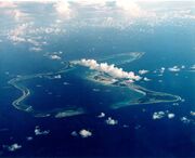
Diego Garcia is an island atoll located south of the equator in the central Indian Ocean. Diego Garcia is a part of the British Indian Ocean Territory (BIOT) and is among thousands of other small islands located within British Indian Ocean Territory. These islands were claimed by the British in 1814 and later established as British territory in 1965. Diego Garcia is the largest and only inhabited island.

View of Diego Garcia, showing the Military Base
The atoll is located 3,535 km (2,197 mi) east of Tanzania's coast, 1,796 km (1,116 mi) south-southwest of the southern tip of India (at Kanyakumari) and 4,723 km (2,935 mi) west-northwest of the west coast of Australia (at Cape Range National Park, Western Australia). Diego Garcia lies in the Chagos Archipelago at the southernmost tip of the Chagos-Laccadive Ridge—a vast submarine range in the Indian Ocean, topped by a long chain of coral reefs, atolls, and islands comprising Lakshadweep, Maldives, and the Chagos Archipelago. Local time is UTC+06:00 year-round (DST is not observed).
Administration[]
UK represents the territory internationally. A local government as normally envisioned does not exist. Rather, the administration is represented in the territory by the officer commanding British Forces on Diego Garcia, the "Brit rep". Laws and regulations are promulgated by the commissioner and enforced in the BIOT by Brit rep.
Of major concern to the BIOT administration is the relationship with the United States military forces resident on Diego Garcia. An annual meeting called "The Pol-Mil Talks" (for "political-military") of all concerned is held at the Foreign and Commonwealth Office in London to resolve pertinent issues. These resolutions are formalized by an "Exchange of Notes", or, since 2001, an "Exchange of Letters".
Neither the U.S. nor the UK recognises Diego Garcia as being subject to the African Nuclear Weapons Free Zone Treaty, which lists BIOT as covered by the treaty. It is not publicly known whether nuclear weapons have ever been stored on the island.
British Virgin Islands[]
The British Virgin Islands consist of the main islands of Tortola, Virgin Gorda, Anegada, and Jost Van Dyke, along with over fifty other smaller islands and cays. About 15 of the islands are inhabited. The capital, Road Town, is situated on Tortola, the largest island, which is approximately 20 km (12 mi) long and 5 km (3 mi) wide. The islands have a population of about 28,000, of whom approximately 23,500 live on Tortola.


Flag of the British Overseas Territory of the British Virgin Islands
Administration[]
The Territory operates as a parliamentary democracy. Ultimate executive authority in British Virgin Islands is vested in The Queen, and is exercised on her behalf by the Governor of the British Virgin Islands. The Governor is appointed by the Queen on the advice of the British Government. Defence and most Foreign Affairs remain the responsibility of the United Kingdom.
The most recent constitution was adopted in 2007 (the Virgin Islands Constitution Order, 2007) and came into force when the Legislative Council was dissolved for the 2007 general election. The Head of Government under the constitution is the Premier (before the new constitution the office was referred to as Chief Minister), who is elected in a general election along with the other members of the ruling government as well as the members of the opposition. Elections are held roughly every four years. A Cabinet is nominated by the Premier and appointed and chaired by the Governor. The Legislature consists of the Queen (represented by the Governor) and a unicameral House of Assembly made up of 13 elected members plus the Speaker and the Attorney General.
The current Governor is John Duncan (since 15 August 2014). The current Premier is Orlando Smith (since 9 November 2011), who is leader of the ruling National Democratic Party.
Geography[]
The British Virgin Islands comprise around sixty tropical Caribbean islands, ranging in size from the largest, Tortola 20 km (12 mi) long and 5 km (3 mi) wide, to tiny uninhabited islets. They are located in the Virgin Islands archipelago, a few miles east of the US Virgin Islands. The North Atlantic Ocean lies to the north of the islands, and the Caribbean Sea lies to the south. Most of the islands are volcanic in origin and have a hilly, rugged terrain. Anegada is geologically distinct from the rest of the group and is a flat island composed of limestone and coral.

Road Town, Tortola is the capital city of the British Virgin Islands
Cayman Islands[]
The Cayman Islands are a British Overseas Territory in the western Caribbean Sea. The territory comprises the three islands of Grand Cayman, Cayman Brac and Little Cayman, located south of Cuba and northwest of Jamaica. The Cayman Islands are considered to be part of the geographic Western Caribbean Zone as well as the Greater Antilles. The territory is a major world offshore financial centre.

Flag of the British Overseas Territory of the Cayman Islands
Administration[]
The Cayman Islands are a British overseas territory, listed by the UN Special Committee of 24 as one of the last non-self-governing territories. The current Constitution, incorporating a Bill of Rights, was ordained by a statutory instrument of the United Kingdom in 2009. A 20-seat Legislative Assembly is elected by the people every four years to handle domestic affairs. Of the elected Members of the Legislative Assembly (MLAs), seven are chosen to serve as government ministers in a Cabinet headed by the Governor. The Premier is appointed by the Governor.
A Governor is appointed by the Queen of the United Kingdom on the advice of the British Government to represent the monarch. Governors can exercise complete legislative and executive authority if they wish through blanket powers reserved to them in the constitution. Bills which have passed the Legislative Assembly require Royal Assent before becoming effective. The Constitution empowers the Governor to withhold Royal Assent in cases where the legislation appears to him or her to be repugnant to or inconsistent with the Constitution or affects the rights and privileges of the Legislative Assembly or the Royal Prerogative, or matters reserved to the Governor by article 55. The executive authority of the Cayman Islands is vested in the Queen and is exercised by the Government, consisting of the Governor and the Cabinet. There is an office of the Deputy Governor, who must be a Caymanian and have served in a senior public office. The Deputy Governor is the Acting Governor when the office of Governor is vacant, or the Governor is not able to discharge his duties or is absent from the Cayman Islands. The current Governor of the Cayman Islands is Her Excellency Helen Kilpatrick, CBE, and the current Deputy Governor is Franz Manderson, MBE. Since 2000, there have been two official major political parties: United Democratic Party (UDP) and the People's Progressive Movement (PPM). While there has been a shift to political parties, many contending for an office still run as independents.
Geography[]
The Cayman Islands are in the western Caribbean Sea and are the peaks of a massive underwater ridge, known as the Cayman Ridge (or Cayman Rise). This ridge flanks the Cayman Trough, 6,000 m (20,000 ft) deep which lies 6 km (3.7 mi) to the south. The islands lie in the northwest of the Caribbean Sea, east of Quintana Roo, Mexico and the Yucatan Mexico, south of Cuba and west of Jamaica. They are situated about 700 km (430 mi) south of Miami, 750 km (470 mi) east of Mexico, 366 km (227 mi) south of Cuba, and about 500 km (310 mi) northwest of Jamaica. Grand Cayman is by far the biggest, with an area of 197 sq km (76 sq mi). Grand Cayman's two "Sister Islands", Cayman Brac and Little Cayman, are about 120 km (75 mi) east north-east of Grand Cayman and have areas of 38 and 28.5 sq km (14.7 and 11.0 sq mi) respectively.
Cyprus[]
Cyprus is a British Overseas Territory in the Eastern Mediterranean. It got its independence in 1960 but in 1974 the there was a coup d'etat and a Turkish invasion (The invasion lasted less than a week due to Turkey and Britain talking about what to do with the Turkish Cypriots. They came to an agreement where Turkish Cypriots would be on the same equal footing as the Greek Cypriots.). President Makarios III after fleeing to London asked the British Government to take Cyprus back so Democracy could be restored. On the 18th of July in response to President Makarios III's calls for Britain to restore democracy in Cyprus, British troops marched into Limassol and Larnaca from Akrotiri and Dhekelia respectively. On the 20th, they marched into Nicosia to be greeted by thousands of cheering Cypriots and President Makarios III (who was now Premier of Cyprus) who had returned at 5AM earlier that day due to Nikos Sampson committing suicide. His last words were “I'd rather die than be a subject under British rule.” The British Government then went on to ban EOKA ( Nikos Sampson was a member) and disband the Cypriot National Guard replacing it with British Armed Forces Cyprus


.svg)
Flag of the British Overseas Territory of Cyprus
Administration[]
The Territory operates as a parliamentary democracy. Ultimate executive authority in Cyprus is vested in The Queen, and is exercised on her behalf by the Governor of the British Virgin Islands. The Governor is appointed by the Queen on the advice of the British Government. Defence and most Foreign Affairs remain the responsibility of the United Kingdom.
The political environment is dominated by the communist AKEL, the liberal conservative Democratic Rally, the centrist Democratic Party, the social-democratic EDEK and the centrist EURO.KO.The Head of Government is the Premier, who is elected in a general election along with the other members of the ruling government as well as the members of the opposition. Elections are held roughly every four years. A Cabinet is nominated by the Premier and appointed and chaired by the Governor. The Legislature consists of the Queen (represented by the Governor) and a unicameral House of Assembly made up of 13 elected members plus the Speaker and the Attorney General.
Geography[]
Cyprus is the third largest island in the Mediterranean Sea, after the Italian islands of Sicily and Sardinia (both in terms of area and population). It is also the world's 81st largest by area and world's 51st largest by population. It measures 240 km (149 mi) long from end to end and 100 km (62 mi) wide at its widest point, with Turkey 75 km (47 mi) to the north. It lies between latitudes 34° and 36° N, and longitudes 32° and 35° E.
Dominica[]
Dominica, officially the Commonwealth of Dominica, is an island territory in the Lesser Antilles region of the Caribbean Sea, south-southeast of Guadeloupe and northwest of Martinique. Its area is 750 square kilometres (290 sq mi) and the highest point is Morne Diablotins, at 1,447 metres (4,747 ft) elevation. The population was 72,301 at the 2014 census. The capital is Roseau, located on the leeward side of the island.

Flag of Dominica
History[]
The island was originally inhabited by the Kalinago and later colonised by the Europeans, predominately by the French, who arrived at the island on Sunday, 3 November 1493 ("Sunday" = "Domenica" in Italian). Great Britain took it over in 1763 after the Seven Years' War and gradually established English as the official language. Independence movements have been hampered by economic misfortune and natural disasters. There have been two referenda, one in 1993 and another in 2007. The results were,
- 1993 referendum - 56% voted against independence, 44% voted for independence
- 2007 referendum - 54% voted against independence, 46% voted for independence
Falkland Islands[]
The Falkland Islands are an archipelago in the South Atlantic Ocean on the Patagonian Shelf. The principal islands are about 300 mi (480 km) east of South America's southern Patagonian coast, at a latitude of about 52°S. The archipelago, with an area of 4700 sq mi (12,000 sq km), comprises East Falkland, West Falkland and 776 smaller islands. As a British overseas territory, the Falklands have internal self-governance, and the United Kingdom takes responsibility for their defence and foreign affairs. The islands' capital is Stanley on East Falkland.


Flag of the British Overseas Territory of the Falkland Islands
Controversy exists over the Falklands' discovery and subsequent colonisation by Europeans. At various times, the islands have had French, British, Spanish, and Argentine settlements. Britain reasserted its rule in 1833, although Argentina maintains its claim to the islands. In April 1982, Argentine forces temporarily occupied the islands. British administration was restored two months later at the end of the Falklands War.
Administration[]
The Falkland Islands are a self-governing British Overseas Territory. Under the 2009 Constitution, the islands have full internal self-government; the UK is responsible for foreign affairs, retaining the power "to protect UK interests and to ensure the overall good governance of the territory". The Monarch of the United Kingdom is the head of state, and executive authority is exercised on the monarch's behalf by the Governor, who in turn appoints the islands' Chief Executive on the advice of members of the Legislative Assembly. Both the Governor and Chief Executive serve as the head of government. Governor Colin Roberts was appointed in April 2014; Chief Executive Keith Padgett was appointed in March 2012. The UK minister responsible for the Falkland Islands since 2012, Hugo Swire, administers British foreign policy regarding the islands.
Geography[]
The Falkland Islands have a land area of 4700 sq mi (12,000 sq km) and a coastline estimated at 800 mi (1300 km). Two main islands, West Falkland and East Falkland, and about 776 smaller islands constitute the archipelago. The islands are predominantly mountainous and hilly, with the major exception the depressed plains of Lafonia (a peninsula forming the southern part of East Falkland). The Falklands are continental crust fragments resulting from the break-up of Gondwana and the opening of the South Atlantic that began 130 million years ago. The islands are located in the South Atlantic Ocean, on the Patagonian Shelf, about 300 miles (480 km) east of Patagonia in southern Argentina.
Gibraltar[]
Gibraltar is a British Overseas Territory located on the southern end of the Iberian Peninsula at the entrance of the Mediterranean. It has an area of 6.0 sq km (2.3 sq mi) and shares its northern border with the Province of Cádiz in Andalusia, Spain. The Rock of Gibraltar is the major landmark of the region. At its foot is a densely populated city area, home to almost 30,000 Gibraltarians and other nationalities.


Flag of the British Overseas Territory of Gibraltar
Administration[]
Gibraltar is a British overseas territory. The British Nationality Act 1981 granted Gibraltarians full British citizenship.
Under its current constitution, Gibraltar has almost complete internal democratic self-government through an elected parliament, elected for a term of up to four years. The unicameral parliament presently consists of seventeen elected members, and the Speaker who is not elected, but appointed by a resolution of the parliament. The government consists of ten elected members. The head of state is Queen Elizabeth II, who is represented by the Governor of Gibraltar. The governor enacts day-to-day matters on the advice of the Gibraltar Parliament, but is responsible to the British Government in respect of defence, foreign policy, internal security and general good governance. Judicial and other appointments are made on behalf of the Queen in consultation with the head of the elected government.
The 2011 election was contested by the Gibraltar Social Democrats (GSD), Gibraltar Socialist Labour Party (GSLP)-Gibraltar Liberal Party (GLP) Alliance and the Progressive Democratic Party (PDP). The PDP is a new party, formed in 2006 and fielded candidates in the 2007 election, but none were elected. The head of government is the Chief Minister (as of December 2011, Fabian Picardo). All local political parties oppose any transfer of sovereignty to Spain, instead supporting self-determination. The main UK opposition parties also support this policy and it is UK Government policy not to engage in talks about the sovereignty of Gibraltar without the consent of the people of Gibraltar.
Geography[]
Gibraltar's territory covers 6.843 sq km (2.642 sq mi) and shares a 1.2 km (0.75 mi) land border with Spain. The town of La Línea de la Concepción, a municipality of the province of Cádiz, lies on the Spanish side of the border. The Spanish hinterland forms the comarca of Campo de Gibraltar (literally "Countryside of Gibraltar"). The shoreline measures 12 km (7.5 mi) in length. There are two coasts ("Sides") of Gibraltar: the East Side, which contains the settlements of Sandy Bay and Catalan Bay; and the Westside, where the vast majority of the population lives. Gibraltar has no administrative divisions but is divided into seven Major Residential Areas.
Having negligible natural resources and few natural freshwater resources, limited to natural wells in the north, until recently Gibraltar used large concrete and/or natural rock water catchments to collect rainwater. Fresh water from the boreholes is supplemented by two desalination plants: a reverse osmosis plant, constructed in a tunnel within the rock, and a multi-stage flash distillation plant at North Mole.
Gibraltar's terrain consists of the 426-m-high (1398 ft) Rock of Gibraltar made of Jurassic limestone, and the narrow coastal lowland surrounding it. It contains many tunnelled roads, most of which are still operated by the military and closed to the general public.
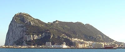

Rock of Gibraltar
Grenada[]
Grenada is an island territory consisting of Grenada itself and six smaller islands at the southern end of the Grenadines in the southeastern Caribbean Sea. Grenada is located northwest of Trinidad and Tobago, northeast of Venezuela, and southwest of Saint Vincent and the Grenadines. Grenada is also known as the "Island of Spice" because of the production of nutmeg and mace crops, of which it is one of the world's largest exporters. Its size is 344 square kilometres (133 sq mi), with an estimated population of 110,000. Its capital is St. George's. The national bird of Grenada is the critically endangered Grenada dove.

Official Flag of Grenada
History[]
It intially won independence in 1974, however, after a communist revolution in 1979 and the American invasion of it in 1983 questions were raised about Grenada's stability. The Americans arranged a deal with the United Kingdom in which Grenada would be brought back under UK control. A referendum in Grenada was held on this issue and 53% voted in favour of re-joining the UK. The UK reluctantly accepted and promised to work towards a democratic future in Grenada.
Administration[]
It has its own assembly using powers devolved by Westminster. 2 MPs are elected to Westminster. There are 4 parties and these are;
- Grenadian Labour Party
- Grenadian Conservative Party
- Grenadian Liberal Democrats
- Grenadian Green Party
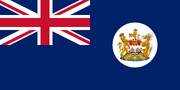
Hong Kong[]
It is considered to be the most successful, prosperous and patriotic Overseas Territory. It is located in South East China and it has a coastline which is part of the South China Sea. It has a GDP of nearly $450 billion.

.svg)
Flag of the British Overseas Territory of Hong Kong
Administration[]
The Territory operates as a parliamentary democracy. Ultimate executive authority in Hong Kong is vested in The Queen, and is exercised on her behalf by the Governor of Hong Kong. The Governor is appointed by the Queen on the advice of the British Government. The current Governor is Martin Lee, He was appointed in 2008 due to several factors (He was Popular with Hong Kongers and he was pro-British and Democracy). Defence and most Foreign Affairs remain the responsibility of the United Kingdom. There are 3 parties which are the Democratic Party (governing), the Labour and Social Democrats Party and the Liberal Party.
Geography[]
Hong Kong is located on China's south coast, 60 km (37 mi) east of Macau (A Portuguese Colony) on the opposite side of the Pearl River Delta. It is surrounded by the South China Sea on the east, south, and west, and borders the Guangdong city of Shenzhen to the north over the Shenzhen River. The territory's 1,104 km2 (426 sq mi) area consists of Hong Kong Island, the Kowloon Peninsula, the New Territories, and over 200 offshore islands, of which the largest is Lantau Island. Of the total area, 1,054 km2 (407 sq mi) is land and 50 km2 (19 sq mi) is inland water. Hong Kong claims territorial waters to a distance of 3 nautical miles (5.6 km). Its land area makes Hong Kong the 179th largest inhabited territory in the world. In comparison to North American cities, Hong Kong is tiny yet heavily populated. An example could be the city Edmonton, with a metro population of about 1.4 Million, making the city considerably smaller in population than Hongkong's 7.4 Million. However, Edmonton's metro area totals nearly 10,000 km2 (3,900 sq mi) making the city almost ten times larger than Hong kong. Also, The Greater Los Angeles area is over 87,000 km2 (34,000 sq mi), and with 18 million residents, has an incredibly low density when compared to Hong Kong and is 79 times larger in area.
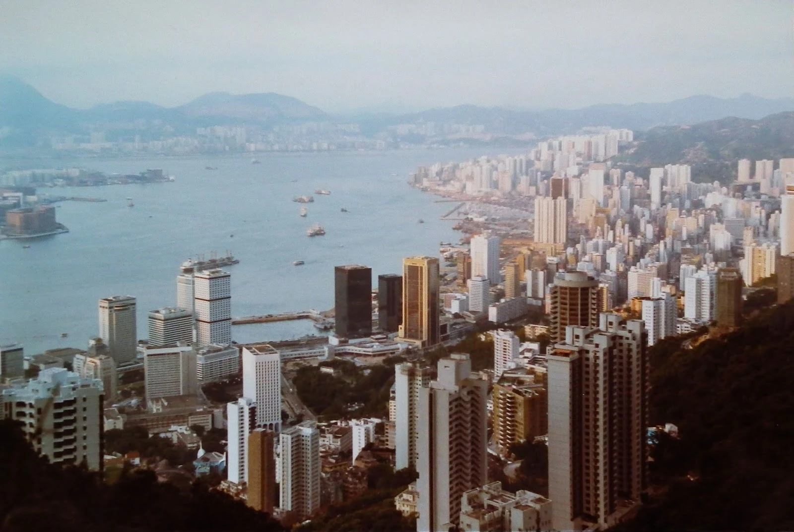
View of Hong Kong in 1980
Malta[]
Malta is a Southern European island territory comprising an archipelago in the Mediterranean Sea. It lies 80 km (50 mi) south of Italy, 284 km (176 mi) east of Tunisia, and 333 km (207 mi) north of Libya. The country covers just over 316 km2 (122 sq mi), with a population of just under 450,000 (despite an extensive emigration programme since the Second World War), making it one of the world's smallest and most densely populated countries. The capital of Malta is Valletta, which at 0.8 km2, is the smallest national capital in the European Union. Malta has two official languages: Maltese and English.


.svg)
Flag of the British Overseas Territory of Malta
Administration[]
It has 5 MPs in the British House of Commons. It has its own parliament using powers devolved by Westminster. Political Parties include the Maltese Labour Party and the Maltese Conservative Party. The five Westminster constituencies are Gozo and Comino, North Malta, South Malta, Valletta West and Valletta East.
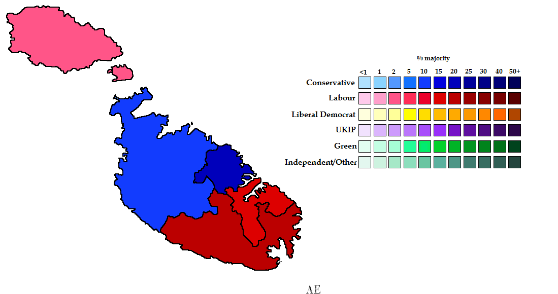

Maltese results of 2015 UK General Election