| ||||||
| Capital | Phoenix | |||||
| Largest City | Phoenix | |||||
| Other Cities | Tucson, Las Vegas, Colorado City, Yuma, Flagstaff | |||||
| Language | English | |||||
| Ethnic Groups Main |
White (non-Hispanic), Hispanic | |||||
| Others | Native American, Black, Asian | |||||
| Demonym | Arizonan | |||||
| Government | Representative democracy | |||||
| Legislature | State Legislature | |||||
| Governor | Fife Symington III (R) | |||||
| Population | 7,977,000 | |||||
| Admission | February 1907 | |||||
| Currency | USD | |||||
| Time Zone | Mountain & Pacific Standard | |||||
| Summer | Mountain Daylight (Navajo Nation) | |||||
| Abbreviations | AZ | |||||

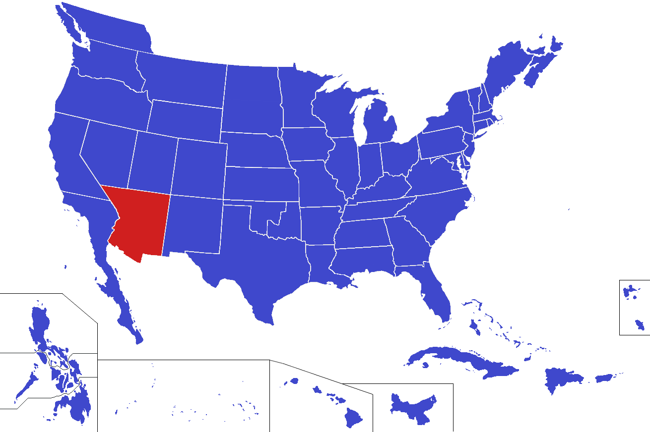
Arizona (AZ) is a state located in the Southwestern/southern Mountain Region of the United States that shares borders with South California and North California to the west, Nevada and Deseret to the north, New Mexico to the east, and the Mexican province of Sonora to the south. Arizona is a largely desert state, with much of its populace of just under eight million living in major cities like the state capital and largest city of Phoenix (pop. 1,509,000), Tucson, Las Vegas, Colorado City, or Yuma.
Originally a part of the Viceroyalty of New Spain beginning in the 1700s, Arizona eventually became part of the Mexican state of Alta California following that nation's independence in 1821. Following the Mexican American War of 1846-47, modern-day Arizona was included in the territory transferred to the United States as part of the Treaty of Guadalupe Hidalgo (1848). From 1850 to 1865, Arizona comprised the western half of the Union's New Mexico Territory, after which time it became the separate Arizona Territory. It was finally admitted to the Union as the 49th state on February 14, 1907.
The state is home to the world-famous Grand Canyon – a major domestic and international tourist attraction – and one of the largest populations of Native Americans in the United States, namely the Navajo, Hopi, and Apache tribes. Of these, the Navajo Nation (situated in Navajo, Coconino and Apache Counties) is the largest.
Counties[]
Arizona is subdivided into 18 counties, which are listed below in order of population.
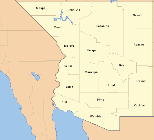
.png)
A map of counties in Arizona.
| Rank | Name | County Seat | Population |
|---|---|---|---|
| 1 | Maricopa County | Phoenix | 3,000,000 |
| 2 | Mead County | Las Vegas | 1,631,000 |
| 3 | Pima County | Tucson | 1,160,000 |
| 4 | Gulf County | Colorado City | 730,000 |
| 5 | Pinal County | Florence | 375,000 |
| 6 | Yavapai County | Prescott | 295,000 |
| 7 | Yuma County | Yuma | 227,000 |
| 8 | Cochise County | Bisbee | 145,000 |
| 9 | Coconino County | Flagstaff | 151,000 |
| 10 | Navajo County | Chinle | 95,000 |
| 11 | Apache County | St. Johns | 70,000 |
| 12 | Gila County | Globe | 47,000 |
| 13 | Graham County | Safford | 38,000 |
| 14 | Pah-Ute County | Mesquite | 32,000 |
| 15 | Wembler County | Caborca | 29,700 |
| 16 | Mojave County | Kingman | 25,000 |
| 17 | La Paz County | Parker | 17,500 |
| 18 | Moapa County | Moapa | 9,800 |