Cortés is the southern continent of the western hemisphere, named for the Spanish Conquistador who died subjugating the warriors of the Aztec.
Etymology[]
Although Martin Waldseemüller originally named the continent America, after the explorer Amerigo Vespucci who charted much of the coast, after Hernan Cortés died adding Mexico to the Spanish Empire in 1521, King Charles I of Spain ordered that all maps produced under the Spanish Empire label the land as Cortés. Vinlandia having become a far too common name for the Northern continent across Europe to consider attaching Cortés' name to it. With the Portuguese the only others to extensively chart the continent soon the only accurate maps of the land were labeled with this name.
Geography and Extent[]
Cortés occupies the southern portion of the landmasses referred to as the New World. The continent is
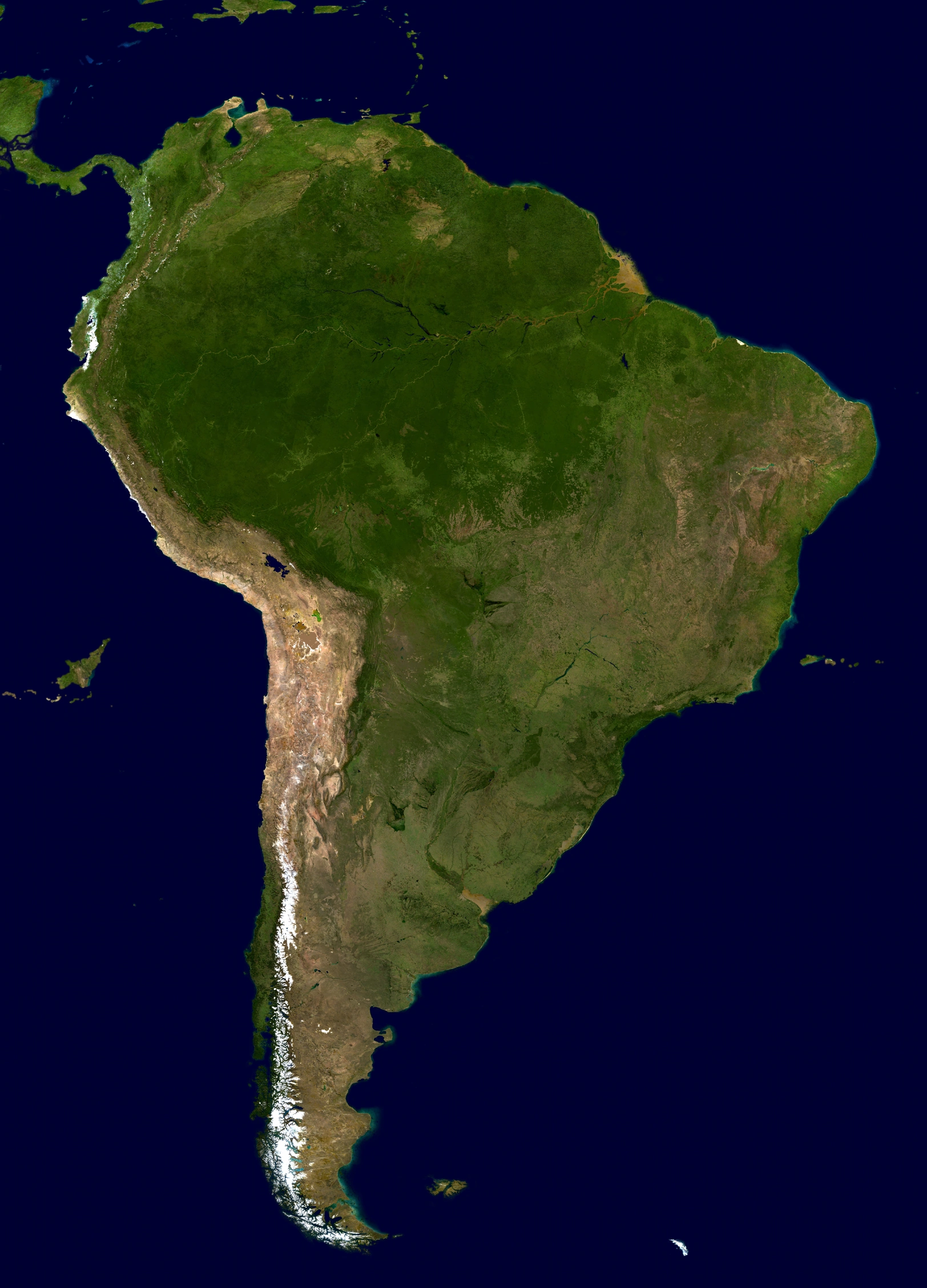
Satellite image of Cortés
generally delimited on the northwest by the Strait of Panama . Almost all of mainland Cortés sits on the Cortésian Plate.
Many of the islands of the Caribbean (or West Indies) sit atop the Caribbean Plate, a tectonic plate with a diffuse topography. The islands of Aruba, Barbados, Trinidad, and Tobago sit on the northerly Cortésian continental shelf. The Dutch West Indies and the federal dependencies of Neuhansa lie along the northerly Cortésian shelf. Geopolitically, the island states and overseas territories of the Caribbean are generally grouped as a part or subregion of Vinlandia. The Cortésian nations that border the Caribbean Sea—including Colombia, Neuhansa, Guyana, Suriname, and Royal Guiana—are also known as Caribbean Cortés. Other islands are the Galápagos islands that belong to Königinland and Easter Island (in Oceania but belongs to Chile), the Nazca Islands, Jaseur Islands, Robinson Crusoe Island, Chiloé, and the Tierra del Fuego.
Cortés is home to the world's highest waterfall, Angel Falls in Guyana; the largest river (by volume), the Amazon River; the longest mountain range, the Andes (whose highest mountain is Aconcagua at 6,962 m [22,841 ft]); the driest place on earth, the Atacama Desert; the largest rain forest, the Amazon Rain forest; the highest commercially navigable lake in the world, Lake Titicaca; and, excluding research stations in Antarctica, the world's southernmost permanently inhabited community, Havenstier, Randewerlde.
Cortés' major mineral resources are gold, silver, copper, iron ore, tin, and petroleum. The many resources of Cortés have brought high income to its countries especially in times of war or of rapid economic growth by industrialized countries elsewhere. However, the concentration in producing one major export commodity often has hindered the development of diversified economies. The fluctuation in the price of commodities in the international markets has led historically to major highs and lows in the economies of Cortésian states, often causing extreme political instability. This is leading to efforts to diversify production to drive away from staying as economies dedicated to one major export.
Cortés is one of the most biodiverse continents on earth. Cortés is home to many interesting and unique species of animals including the llama, anaconda, piranha, jaguar, vicuña, and tapir. The Amazon rain forests possess high biodiversity, containing a major proportion of the Earth's species. Regions in Cortés include the Andean States, the Guianas, the Southern Cone, and Brazil which is the largest country by far, in both area and population.
Countries and Territories[]
| Country or Territory | Area | Population | Capital |
| Rio De Janeiro | |||
|
British Overseas Territory of the Falkland |
|||
| Chile | Santiago | ||
| Colombia | |||
| Dutch West Indies (Netherlands) | |||
|
Guyana |
Lewelton | ||
| Inca | Cuzco | ||
| Jaseur Islands | Suitbert | ||
| Königinland | Neu Lübeck | ||
|
|
St. Louis | ||
| Nazka | St. Boniface | ||
| Neuhansa | Neu Bremen | ||
| Kersauzon | |||
| Patagonia | |||
| Peru | |||
| Randewerld | |||
| St. Jeanne | |||
| Suriname | |||
| United Cortésian Principalities |

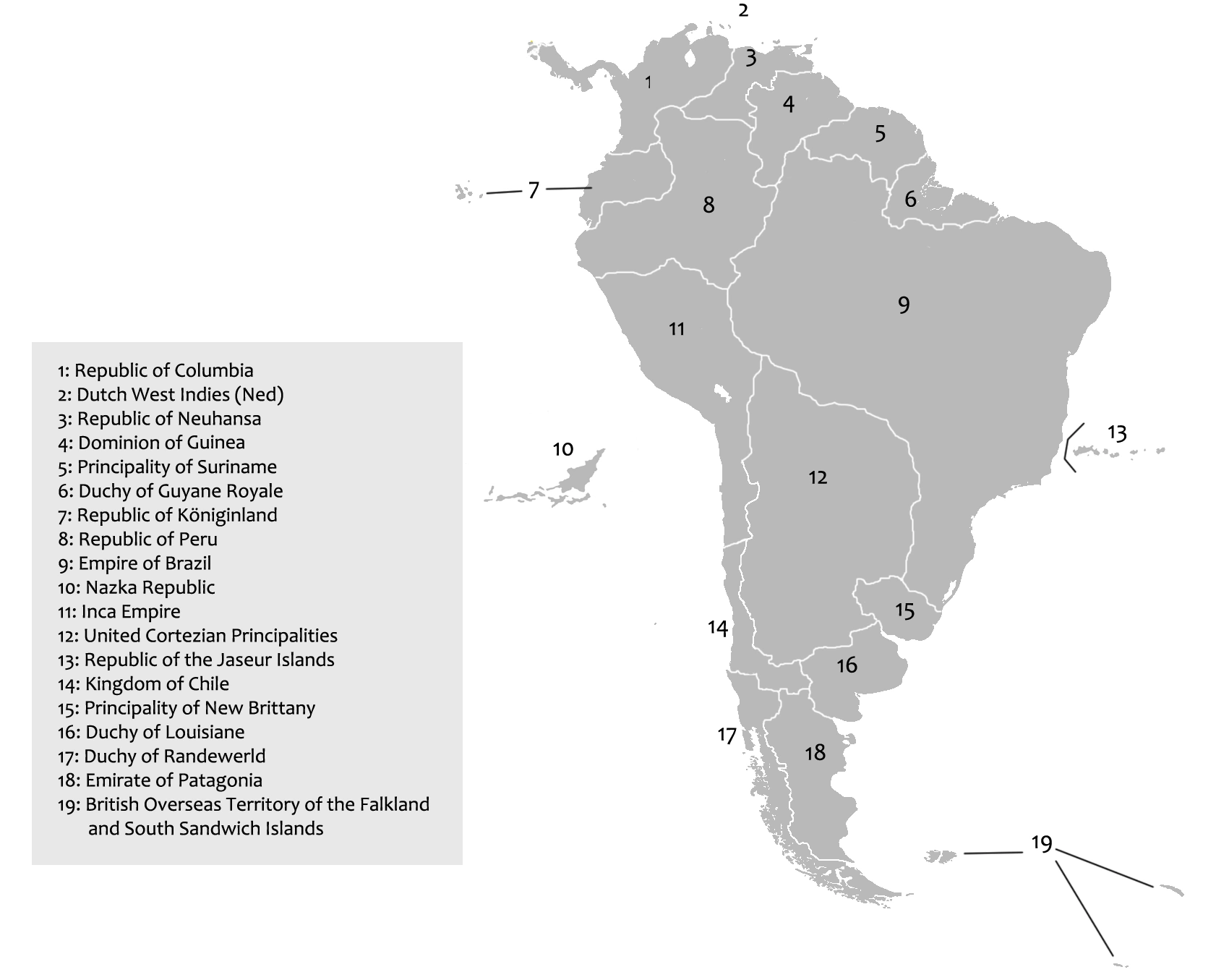
Political boundaries of modern Cortés (Subject to change)